
ASC Map


This map shows where the 543 participants in our research on Advancing Accessibility Standards through Inuit Qaujimajatuqangit were located across Nunavut and Canada.
Map
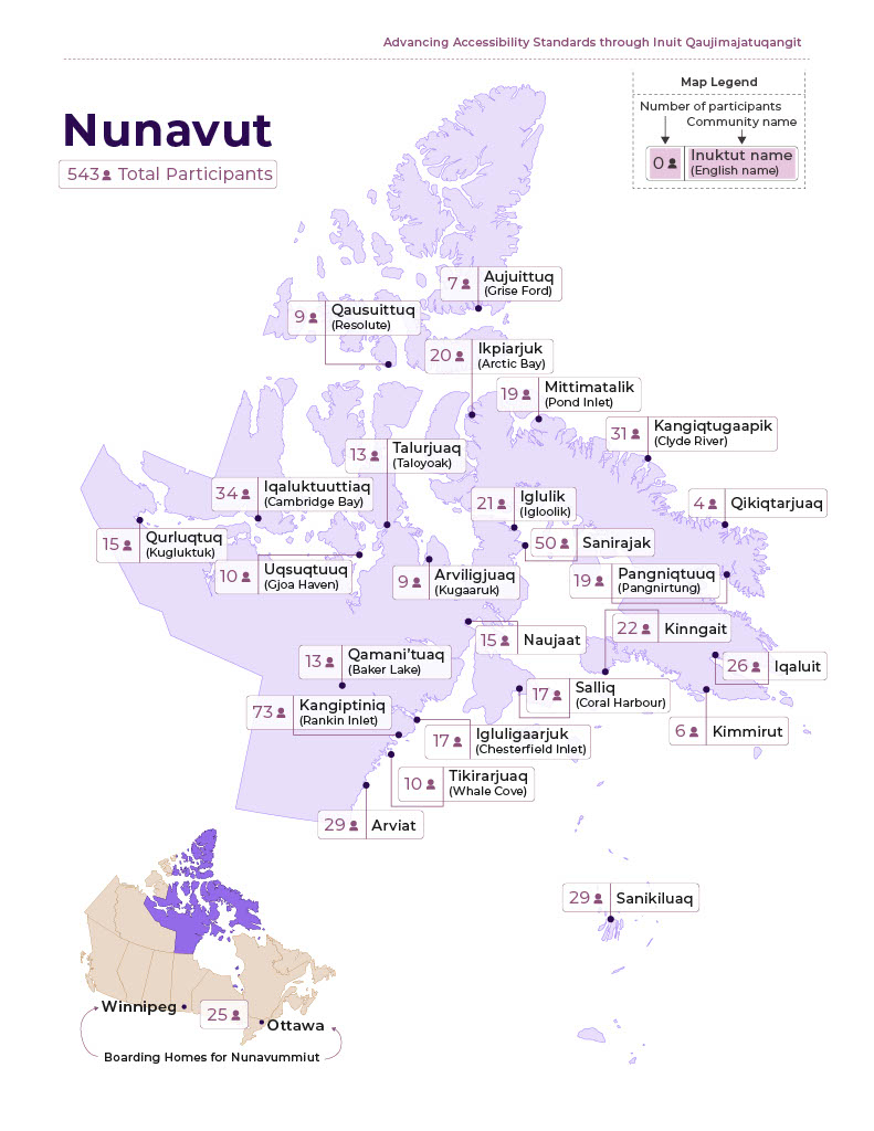
- Aujuittuq (Grise Ford): 7
- Qausuittuq (Resolute): 9
- Ikpiarjuk (Artic Bay): 20
- Mittimatalik (Pond Inlet): 19
- Kangiqtugaapik (Clyde River): 31
- Talurjuaq (Taloyoak): 13
- Iqaluktuuttiaq (Cambridge Bay): 34
- Iglulik (Igloolik): 21
- Qikiqtarjuaq: 4
- Qurluqtuq (Kugluktuk): 15
- Uqsuqtuuq (Gjoa Haven): 10
- Arviligjuaq (Kugaaruk): 9
- Sanirajak: 50
- Pangniqtuuq (Pangnirtung): 19
- Naujaat: 15
- Kinngait: 22
- Qamani’tuaq (Baker Lake): 13
- Salliq (Coral Harbour): 17
- Iqaluit: 26
- Kangiptiniq (Rankin Inlet): 73
- Igluligaarjuk (Chesterfield Inlet): 17
- Kimmirut: 6
- Tikirarjuaq (Whale Cove): 10
- Arviat: 29
- Sanikiluaq: 29
- Winnipeg and Ottawa (Boarding Homes for Nunavummiut): 25